

Altinbesik Cave (Altınbeşik Mağarası) is on the western side of the steep Manavgat Hill, 7 km from Ibradi (Aydinkent) district of Antalya, and 5 km southeast of Urunlu village. Altinbesik Cave National Park is accessible via the Antalya – Ibradi – Urunlu road, then a one-hour walk from Urunlu to Altinbesik Cave.
The Altinbesik Cave is a horizontal and partly active cave system, and its name comes from the Altinbesik Hill, on the upper side of the cave. This region of the Taurus Mountains has a very complex geological and geomorphologic structure with geological overlaps, large twists and deep valleys. The Altinbesik Cave was carved into old limestone in the upper Creosote.
Many caves and lakes are to be found underground. The lakes are at different levels, resulting in eascades. Huge stalagtites and stalagmites can be seen in the caves. It has taken millions of years to create the present formation of the lakes and the caves. The theory of their formation is as follows: due to the limestone nature of this mountainous area, the water trickled into the cracks and following chemical reactions in some places, melting occurred and small cavities resulted. In time, due to the deleterious effects of the water, the cavities grew bigger and became caves. This process has continued to our day. Those interested in this subject and are hardy climbers will be rewarded with a sight of unparalleled beauty.
Altinbesik Cave is one of the most unusual subterranean lakes in the world. It was developed on three levels, and the bottom and middle levels are active in the rainy seasons, and the upper level is always dry. The lowest level is still active with an underground river, rimstone pools and waterfalls. That is the reason why it is sometimes called Altinbesik Waterfalls (Altınbeşik Düdeni). The Altinbesik Cave acts as an underground stream which releases water which has collected underground. In the autumn there are many stationary ponds, and in the spring, many streams flow from the sub and middle levels of the cave. In the upper level, there are stalactites and stalagmites. The Altinbesik Cave is visited from the resurgence by boat, until a travertine barrier, a rimstone 44 m high, is reached. The first cave lake is 125 m long and up to 9 m deep, and it is followed by a part with many formations. The entrance portal is 40 m wide and 40 m high. Altinbesik Cave’s highest point is 101 meters high.
The underground lake accumulates the source waters of the Manavgat River before it transforms into a river and it is a true natural wonder that can also be traversed by boat. The Altinbesik Cave Lake is part of the submerged waters of Lake Gembos. The water discharged from Manavgat River has carved out anatural bridge in the cave and unusual formations in Altinbesik Cave walls document and demonstrate the power of this flow. Moreover, the rich flora around the cave and karst topography Altinbesik wild beauty of the landscape values constitute the National Park.
World Wild Fund For Nature (WWF) has identified in 1999 the 100 forest areas, which are the most valuable in terms of biodiversity in Europe and which must urgently be protected, and it has been pointed out that one of these areas, which are identified as “The Hot Spots of European Forests” and nine of which are found in Turkey, is the natural areas around Íbradi-Akseki. Within the area 9 different kinds of communities belonging to the forest, maquis, hygrophilic, rock and scree vegetations have been diagnosed, namely Crataegus monogyna-Pinus brutia, Tordylium ketenoglui-Juniperus excelsa, Pistacia terebinthus-Quercus coccifera, Phillyrea latifolia-Arbutus andrachne, Nerium oleander-Platanus orientalis, Onosma frutescens basis community, Arabis davisii-Alkanna oreodoxa, Bupleurum erubescens-Pelargonium endlicherianum, Geranium lucidum-Ricotia sinuata. Within the area, a clear dominance of Quercetea ilicis, Quercetalia ilicis and Quercion calliprini has been identified. In addition to Altinbesik Cave National Park, the surrounding area of the Manavgat Valley has a great natural beauty, and Uruncu is known for its impressive local architecture.
Four National Parks and one Natural Park serve on a 79,366 hectare field in Antalya borders. The working area of Antalya National Park Department contains geomorphologic and geologic features along with many matchless beauties, including archaeological and aesthetical characteristics; unique rich plantation cover and animal group, where the most intense tourism activities are carried out in Turkey.
1- Olympos – Bey Mountains Coastal National Park
2- Koprulu Canyon National Park
3- Gulluk Mountain Termessos National Park
4- Altınbeşik Cave National Park
5- Kurşunlu Waterfall Natural Park
National Parks, Nature Parks, Nature Reserve Areas And Wildlife Reserve Areas Near Antalya
Antalya
Maps Of Antalya
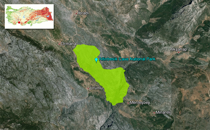 Altinbesik Cave National Park Map


